|
|
     aHR0cDovL2ZyZWVzaGlwLmNvLmty aHR0cDovL2ZyZWVzaGlwLmNvLmty
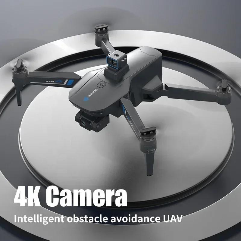
- 비디오 최대 해상도 [Pixel X Pixel]: 4K(4096*2160)
- 카테고리: 카메라 드론
- Aircraf 동작 주파수: 2.4GHz
- GPS: 그렇습니다
- 연결성: APP 컨트롤러
- 작동 시간: 31min
- 센서 크기: 1/2.3인치
- Camera Integration: 카메라 포함
- 카메라 기능: 4K HD Video Recording
- 브랜드 이름: DJI
- DJI 모델: DJI FPV
- 근원: CN (정품)
- 공중 사진: 그렇습니다
- Lens: FOV: 150°
- ISO: 100-12800
- Shutter Speed: 1/50-1/8000 s
- Still Photography Modes: Single shot
- Max Image Size: 3840x2160
- Photo Format: JPEG
- Video Resolution: 4K: 3840x2160 at 50/60fps ,FHD: 1920x1080 at 50/60/100/120fps
- Video Formats: MP4/MOV
- Max Video Bitrate: 120 Mbps
- Color Profile: Standard, D-Cinelike
- RockSteady EIS: Available
- Distortion Correction: Available
- Supported File Formats: exFAT (recommended) FAT32
- Mechanical Range: Tilt: -65° to 70°
- Controllable Range: Tilt: -50° to 58°
- Stabilization: Single-axis (tilt), electronic roll axis
- Max Control Speed: 60°/s
- Electronic Roll Axis: Available (can stabilize footage when the aircraft is tilted at angles of up to 10°)
- Takeoff Weight: Approx. 795 g
- Diagonal Distance: 245 mm
- Max Service Ceiling Above Sea Level: 6,000 m
- Max Flight Time: Approx. 20 mins (measured while flying at 40 kph in windless conditions)
- Max Hover Time: Approx. 16 mins (measured when flying in windless conditions)
- Max Flight Distance: 16.8 km (measured while flying in windless conditions)
- Operating Temperature: -10° to 40° C (14° to 104° F)
- Number of Antennas: Four
- GNSS: GPS+GLONASS+GALILEO
- Supported SD Cards: microSD (up to 256 GB)
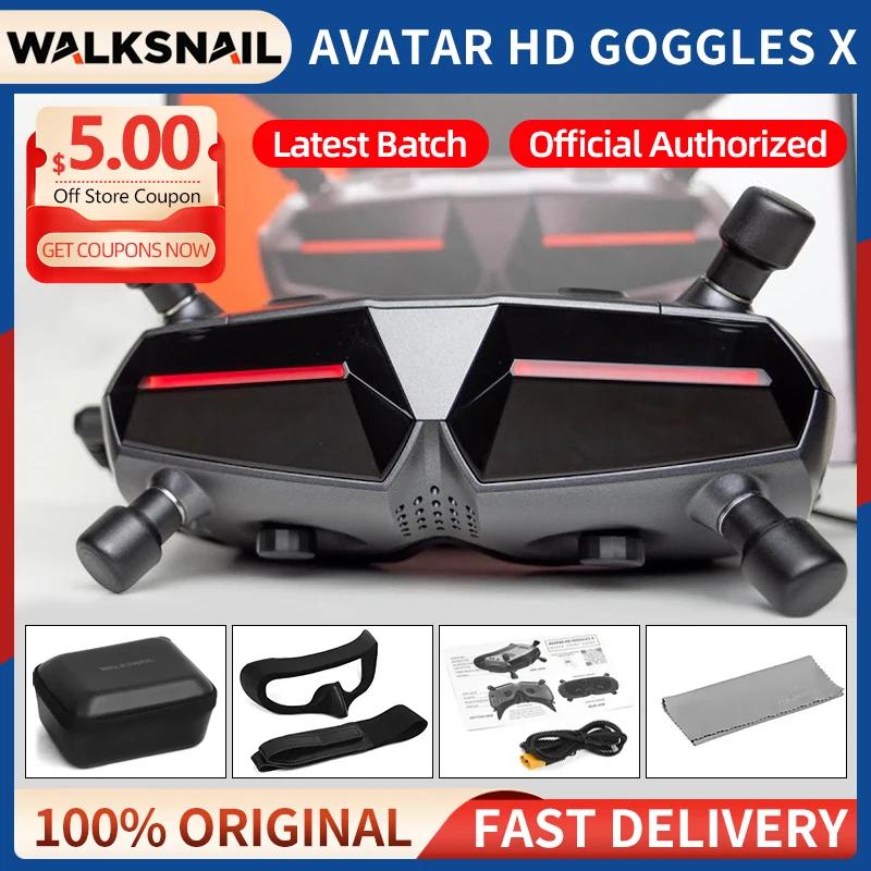
옵션정보[(29)FPV Combo] DJI FPV 콤보
몰입형 비행 경험
4K/60fps 슈퍼 와이드 150 ° FOV
10km HD 저지연 비디오 전송
브랜드-새로운 S 모드
비상 브레이크 및 호버
 
    
|
|
|
|
|


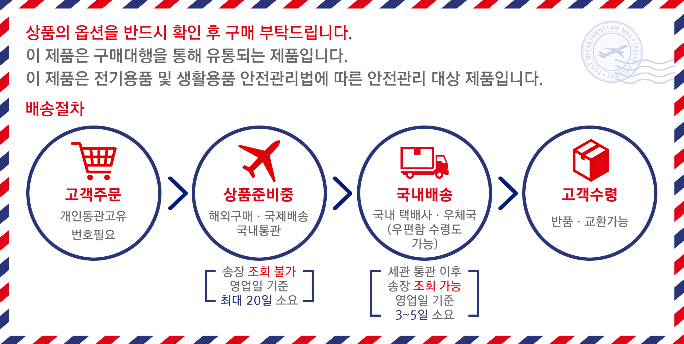
 배송기간
배송기간