|
|
     aHR0cDovL2ZyZWVzaGlwLmNvLmty aHR0cDovL2ZyZWVzaGlwLmNvLmty
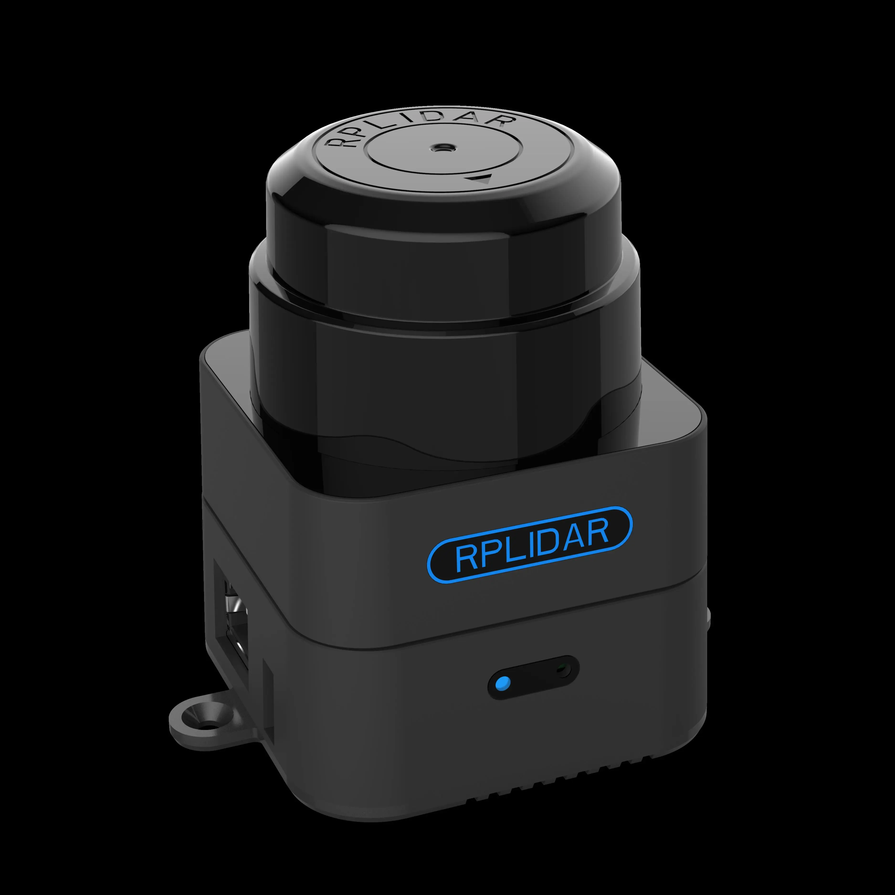
- 브랜드 이름: rplidar
- 증명서: 세륨
- 근원: CN (정품)
- 모델 번호: M2M2
- Color: Black
- Measure distance: 40m
- Max measure area: 300m*300m
- Certificate: CE
- Max power voltage: 5.3V
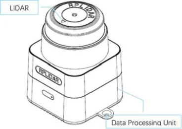
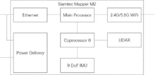
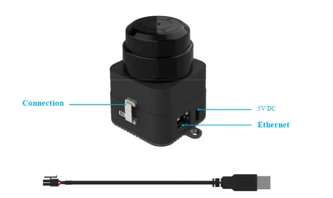
옵션정보[(200015064)BLACK PEARL] Introduction SLAMTEC Mapper is a new type of laser sensor introduced by SLAMTEC, which is different from traditional LIDAR. It has built-in functions of simultaneous localization and mapping (SLAM), and is suitable for many applications such as robot navigation and positioning, environmental mapping and hand-held measurement. System Composition and Connection SLAMTEC Mapper professional kit includes LIDAR sensors and data processing units. Users only need to connect to 5V DC power supply, then with Ethernet or WiFi SLAMTEC Mapper can be easily communicated. Mechanism SLAMTEC Mapper professional kit uses SLAMTEC's unique SLAM optimization algorithm and high-performance LIDAR to fuse map data more than 10 times per second and construct up to 100,000 square meters of mapping area. The LIDAR carries out 9200 measurements per second, and the longest ranging distance can reach 40 meters. The built-in processing system can process data in real time and output high-precision map and pose. Application Scenarios SLAMTEC Mapper can be used in the following application scenarios:
o General robot navigation and localization
o Environment mapping
o Architectural engineering Communication interface SLAMTEC Mapper uses a separate 5V DC power supply. Through simple plug- and-play functions, users can connect it to mobile devices such as mobile phones to create an integrated portable measurement scheme. Power Supply Interface SLAMATEC Mapper professional kit supports DC socket DC power supply and POE[ POE standard: 802.3at Type 2] power supply. External power supply needs to ensure that the current output ability and ripple characteristics of the power supply meet the requirements of the table below to ensure the normal use of the map sensor. Data communication interface SDK and Support In order to facilitate users to use SLAMTEC Mapper for product development and accelerate the development cycle, SLAMTEC provides RoboStudio, a software for robot management and development, which can be debugged graphically through network connection. In addition, SDK development kit which can run on X86 windows, x86 Linux, arm Linux and other platforms is also provided to users. For specific information, please contact SLAMTEC.
|
|
|
|
|


 배송기간
배송기간